Mendoza es una ciudad del oeste de Argentina con una población capitalina de 114 822 hab. Es una de las principales ciudades del país, siendo la cuarta mayor aglomeración de Argentina después de Buenos Aires, Córdoba y Rosario, con 1 086 000 de habitantes (Gran Mendoza).
Es capital de la Provincia de Mendoza. Esta ubicada en la llanura, al este de la inmensa Cordillera de los Andes, su superficie ocupa 105 km², aunque su área metropolitana, se extiende 368 km². Se trata de una de las más importantes ciudades del Cono Sur. Es un principal polo industrial, un punto estratégico fundamental de las relaciones del MERCOSUR.
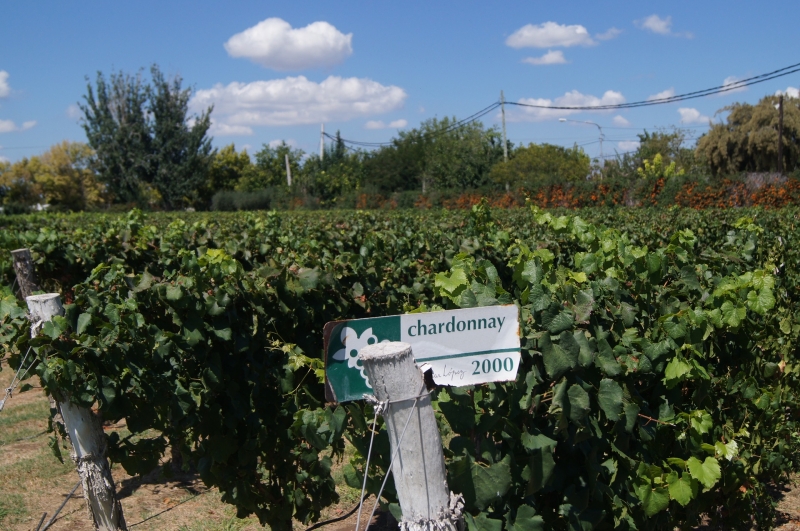
La base de la ciudad actual surgió de un nuevo ordenamiento realizado en 1863 luego del terremoto de 1861, por el agrimensor francés Julio Balloffet y que incluye la disposición estratégica de cuatro plazas menores circundando a una plaza mayor. La actividad económica está vinculada con la industria (elaboración de vinos, alimentos, y otras bebidas) y la extracción y refinación de petróleo.
MENDOZA – ZONA ESTE
El Este es uno de los más extensos oasis de Mendoza, que va desde el río Mendoza hasta el río Desaguadero, límite con la provincia vecina de San Luis.
Fue ésta la tierra que eligió el General San Martín para construir su chacra y hogar rural, anhelando a su retorno el merecido reposo del guerrero. La ruta sanmartiniana se muestra tanto en el camino de las postas coloniales, como en los sitios de la Chacra de Los Barriales, el Museo de las Bóvedas en San Martín, el olivo histórico, el Paseo de la Patria y la propia ciudad de San Martín, como también en el Área Histórica del Molino de Orfila, con la acequia de la Patria o el recordatorio en la Plaza de Los Barriales y su Capilla de Nuestra Señora de la Luz en Junín.
PRECORDILLERA Y ALTA MONTAÑA
Las montañas de Mendoza contrastan con los paisajes rurales y oasis transformados por la labor de los huarpes, incas y conquistadores que transitaron por los actuales departamentos de Las Heras y Luján de Cuyo.
El valle de Potrerillos al pie del Cordón del Plata es el lugar emblemático para los amantes de la aventura y la naturaleza, donde el rafting, trekking, canopy, cabalgatas, son los protagonistas.
Continuado hacia la alta montaña, Uspallata es el centro de estadía que cuenta con una completa base de servicios y es el punto de encuentro de conexiones terrestres de turistas que arriban a la localidad ya sea por el camino de caracoles de Villavicencio o por a RN 7 bordeando el Río Mendoza.
La próxima parada obligatoria para todos los visitantes es el centro de esquí Los Penitentes que alcanza mayor protagonismo durante el periodo invernal para la práctica de actividades deportivas y durante el resto del año funciona como sitio de esparcimiento.
Las Cuevas es el punto culmine del recorrido donde se respira un clima de paz al ascender por un camino de 8 kilómetros de precipicios y pronunciadas curvas hasta arribar al monumento Cristo Redentor que marca los límites entre Argentina y Chile. Este camino es transitable en época estival.
VALLE DE UCO
La mítica Ruta 40 es el gran portal turístico que recorre el Valle de UCO conformado por los departamentos de San Carlos, Tunuyán y Tupungato , es una verdadera postal enmarcada entre el Cordón del Plata y el Portillo, con la vista coronada por el Cerro Tupungato, que domina todas las tierras.
Por el pintoresco camino de los Cerrillos en Tupungato, el mirador del Cristo Rey, lugar religioso con una gigante escultura de Jesucristo se impone en el valle y desde donde pueden apreciarse variados paños con cultivos de frutales de pepita y carozo, como así también hierbas aromáticas, junto a extensos viñedos y alamedas.
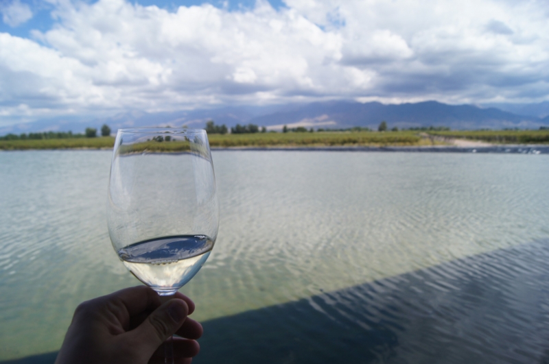
Esta zona se destaca por la producción de excelentes sidras, jugos, conservas y esencias, obtenidas en establecimientos industriales y bodegas de alta gama. Los Caminos del Vino constituyen una apasionante atracción, en la cual la gastronomía gourmet maridada con vinos consagrados, alojamientos temáticos y emprendimientos artesanales se combinan para ofrecer una receta local para alcanzar la más sabrosa placidez.
El Manzano Histórico, al pie del Cordón del Portillo fue escenario de una de las históricas rutas del Ejército de los Andes, distinguiéndose como atractivos el Monumento Retorno a la Patria, que rememora el reposo del guerrero a su regreso a suelo argentino. Complementan este sitio la zona de campings, estación piscícola, centro de interpretación y Vía Crucis.
Toda búsqueda encuentra aquí respuesta, en la paz placentera del avistaje de aves y de manadas de guanacos junto a lagunas y volcanes, en la pacífica lucha de la pesca deportiva o en las bocanadas de aire puro de toda la zona, surge así la experiencia del turismo de naturaleza en la Reserva de la Laguna del Diamante, con la imponente silueta del Volcán Maipo.
Entre los eventos del calendario de festividades sobresalen el Festival Nacional de la Tonada que se realiza en el mes de febrero en Tunuyán y la Fiesta de la Tradición de San Carlos en el mes de noviembre.
FUENTES: MENDOZA TURISMO
MENDOZA is a city in western Argentina with a capital population of 114,822. It is one of the main cities in the country, being the fourth largest crowd in Argentina after Buenos Aires, Córdoba and Rosario, with 1,086,000 inhabitants (Gran Mendoza).
It is the capital of the Province of Mendoza. It is located on the plain, east of the immense Andes Mountains, its surface occupies 105 km2, although its metropolitan area, extends 368 km2. It is one of the most important cities of the Southern Cone. It is a major industrial hub, a key strategic point of MERCOSUR's relations.
The base of the present city arose from a new order made in 1863 after the earthquake of 1861, by the French surveyor Julio Balloffet and which includes the strategic arrangement of four smaller squares surrounding a larger square. Economic activity is linked to industry (winemaking, food, and other beverages) and oil extraction and refining.
MENDOZA - EAST ZONE
The East is one of the largest oasis in Mendoza, ranging from the Mendoza River to the Desaguadero River, bordering the neighboring province of San Luis.
This was the land that General San Martín chose to build his chakra and rural home, longing for his return the well-deserved rest of the warrior. The Sanmartinian route is shown both on the path of the colonial poles, as well as in the sites of the Chacra de Los Barriales, the Museum of the Vaults in San Martín, the historical olive tree, the Paseo de la Patria and the city of San Martín itself, as well as in the Historical Area of the Mill of Orfila, with the ditch of the Fatherland or the reminder in the Plaza de Los Barriales and its Chapel of Our Lady of Light junin.
PRECORDILLERA AND HIGH MOUNTAIN
The mountains of Mendoza contrast with the rural landscapes and oasis transformed by the work of the huarpes, Incas and conquerors who transited through the current departments of Las Heras and Luján de Cuyo.
The potrerillos valley at the foot of the Cordón del Plata is the emblematic place for lovers of adventure and nature, where rafting, trekking, canopy, horseback riding, are the protagonists.
Continued towards the high mountain, Uspallata is the center of stay that has a complete base of services and is the meeting point of terrestrial connections of tourists arriving in the town either by the snail road of Villavicencio or by RN 7 bordering the Mendoza River.
The next mandatory stop for all visitors is the Los Penitentes ski center that reaches the greatest prominence during the winter period for sports activities and for the rest of the year it functions as a recreational site.
Las Cuevas is the culmination point of the route where you can breathe a climate of peace as you ascend a path of 8 kilometers of cliffs and steep curves until you reach the monument Christ the Redeemer that marks the boundaries between Argentina and Chile. This road is walkable in summer season.
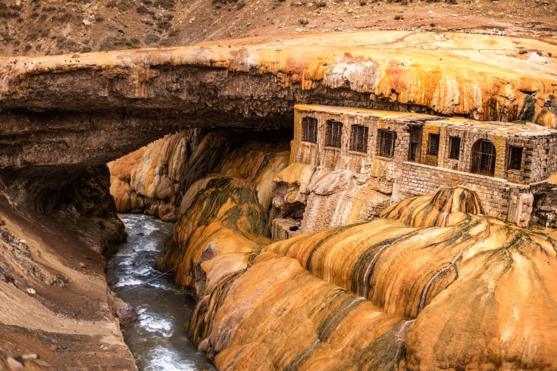
Another option to get to Uspallata from the City of Mendoza, is to travel the RP 52, and cross the villa of Villavicencio in the serranies of the Precordillera. Villavicencio is renowned for the properties of mineral waters and surrounding springs.
UCO VALLEY
The mythical Route 40 is the great tourist portal that runs through the UCO Valley formed by the departments of San Carlos, Tunuyán and Tupungato, is a true postcard framed between the Cordón del Plata and the Portillo, with the view crowned by Cerro Tupungato, which dominates all the lands.
By the picturesque road of the Cerrillos in Tupungato, the viewpoint of Christ the King, religious place with a giant sculpture of Jesus Christ is imposed in the valley and from where you can see various cloths with crops of cucumber fruit and carozo, as well as aromatic herbs, along with extensive vineyards and malls.
This area stands out for the production of excellent ciders, juices, preserves and essences, obtained in industrial establishments and high-end wineries. The Wine Paths are an exciting attraction, in which gourmet gastronomy combines with consecrated wines, themed accommodations and artisanal ventures combine to offer a local recipe to achieve the tastiest placidity.
The Historic Manzano, at the foot of the Cordón del Portillo was the scene of one of the historic routes of the Army of the Andes, distinguishing as attractions the Return to the Fatherland Monument, which recalls the rest of the warrior on his return to Argentine soil. This site is complemented by the campsite area, a piscícola station, an interpretation centre and Via Crucis.
Every search finds here an answer, in the pleasant peace of bird watching and herds of guanacos next to lagoons and volcanoes, in the peaceful fight of sport fishing or in the puffs of pure air throughout the area, thus arises the experience of nature tourism in the Reserve of the Laguna del Diamante, with the imposing silhouette of the Maipo Volcano.
Among the events of the calendar of festivities stand out the National Festival of Tonada that takes place in february in Tunuyán and the Feast of tradition of San Carlos in November.
